In the monitoring system of modern water conservancy projects, radar level meters, as an advanced measurement technology, are widely used in water level monitoring of hydraulic structures such as silt dams. The application principle, advantages and possible problems of radar level meters in silt dam measurement are worth further study.
Warping dams are an important measure for soil and water conservation. Their function is to slow down the flow of water and promote sediment deposition, thereby preventing soil erosion and increasing land use area. However, the effective operation of the dam is inseparable from accurate water level monitoring.
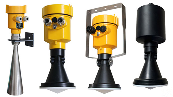
The application of radar level meters has become an innovative solution. Radar level meters are based on microwave radar technology and measure the liquid level by transmitting microwave signals and receiving their echoes. When microwaves encounter the water surface, they will be reflected.
The radar level meter calculates the time difference between transmission and reception to obtain the distance between the liquid surface and the instrument, and then converts it into water level data.
This non-contact measurement method enables the radar level meter to work stably under various severe weather conditions and is not affected by factors such as water pollution and floating objects on the water surface.

In the application of silt dams, the advantages of radar level meters are particularly obvious. First, its high precision and high stability ensure the reliability of water level data and provide strong guarantee for the safe operation of silt dams. Secondly, the non-contact measurement characteristics of radar level meters avoid the shortcomings of traditional equipment that are susceptible to physical damage and extend the service life of the equipment.
Furthermore, radar level meters have good environmental adaptability and can accurately measure water level changes whether it is day or night, sunny or rainy and foggy. However, some problems may also be encountered in actual application.
For example, the propagation of radar waves may be affected by large floating animals or waves, resulting in measurement errors. In addition, extreme climatic conditions such as heavy rain and hail may also interfere with the propagation of radar waves.
For this reason, engineering design and maintenance personnel need to regularly calibrate and maintain radar level meters to ensure their measurement accuracy.

The frequency modulated continuous wave radar level meter has higher resolution and stronger anti-interference ability, and can better adapt to the complex and changing hydrological environment.
At the same time, intelligent data processing methods are also applied to radar level meters, and the speed and accuracy of data processing are improved through algorithm optimization.
