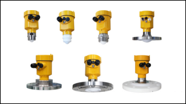
The monitoring of ocean water level at the port quay is crucial for the safety of port operations, ship berthing and cargo loading and unloading. Accurately measuring the water level can effectively prevent potential risks brought by tides and storms and ensure the smooth progress of port operations.
This article will explore the characteristics of ocean water level at the port quay, analyze the application of radar level gauges in this field, and explain it in combination with actual measurement cases.

The ocean water level at the port quay is affected by many factors, including tidal changes, wind action, pressure differences, and natural factors such as the earth’s rotation.
These factors cause the water level to fluctuate frequently and with varying amplitudes, placing high demands on measurement technology. Especially under severe weather conditions, traditional contact measurement methods often fail to meet the requirements of real-time and accuracy.
Radar level meters use a non-contact measurement method to measure the distance by emitting microwave signals and receiving their reflected waves, and then convert the water level height.
This technology is not affected by environmental conditions such as temperature, humidity, fog, and rain, and can provide high-precision and high-stability measurement results.
In addition, the installation and maintenance of radar level meters are relatively simple, making them suitable for long-term continuous monitoring.

In an international port, in order to improve the accuracy and real-time performance of water level monitoring, the management department decided to replace the traditional buoy-type water level gauge with a radar level gauge.
During the project implementation, the technicians first conducted a detailed survey of the shoreline and determined the best installation position and angle to reduce environmental interference and maximize the measurement range.
After the installation was completed, the radar level gauge was successfully operated, and its data was sent to the central control room in real time via wireless transmission.
After a period of comparative testing, the results showed that the data of the radar level gauge was highly consistent with the data measured by traditional methods, and the error was controlled within the allowable range. During the subsequent typhoon, the radar level gauge accurately recorded the rapid changes in water levels, providing strong support for port disaster prevention and mitigation.

Radar level gauges have shown significant technical advantages in measuring ocean water levels on port quaysides. They not only improve the accuracy and reliability of measurements, but also enhance the port’s ability to respond to extreme weather events.
With the continuous advancement of technology, radar level gauges will be widely used in more fields, providing more efficient and intelligent solutions for water level monitoring.
